How GIS Enhances Emergency Planning and Response in Crisis Situations
It’s been a tough few months with the news cycle, hasn’t it? Between natural disasters and tragic accidents, our feeds have been relentless. From devastating wildfires to major flooding and multiple plane crashes, it’s easy to feel overwhelmed. But amidst the chaos, there’s a silver lining: technology is making emergency response more effective than ever. Geographic Information Systems (GIS) are playing a crucial role in helping emergency teams respond faster, coordinate better, and save lives in ways we’ve never seen before.
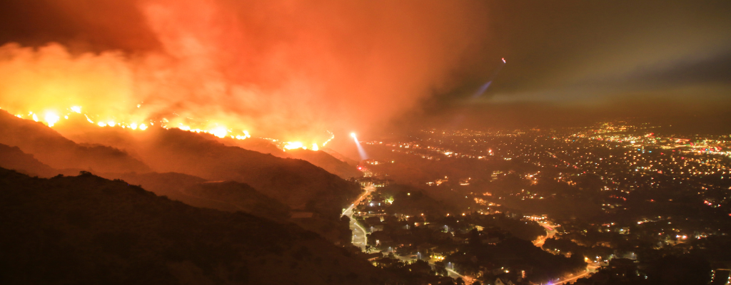
California and Western NC Wildfires: Leveraging GIS for Real-Time Situational Awareness
Wildfires are unpredictable, spreading rapidly due to wind conditions and dry vegetation. Emergency responders rely on GIS to monitor fire perimeters, predict fire paths, and manage evacuations efficiently. Tools like satellite imagery and drone mapping allow agencies to assess damage in real time and allocate resources where they are needed most. The U.S. Forest Service and other local fire agencies use GIS to create fire behavior models that help determine where suppression efforts should be concentrated, ultimately saving lives and minimizing destruction.

Multiple Plane Crashes: How GIS Aids in Emergency Response
The recent surge in plane crashes, including incidents in Washington, D.C., Philadelphia, and Wichita, highlights the importance of GIS in coordinating multi-agency emergency response efforts. GIS enables first responders to quickly assess crash sites, map survivor locations, and establish the fastest routes for medical and rescue units. Real-time mapping tools allow emergency teams to communicate effectively, reducing response times and ensuring medical care reaches those in need as quickly as possible. In aviation incidents, GIS also plays a role in forensic analysis, helping investigators reconstruct the event by analyzing spatial data and flight paths.

Flooding in Western North Carolina and Dallas-Ft. Worth: Using GIS for Risk Assessment and Evacuation Planning
Flooding remains one of the most destructive natural disasters, particularly in regions like western North Carolina and the Dallas-Ft. Worth area, both of which have been hit hard in recent weeks. GIS plays a vital role in flood prediction and mitigation by analyzing terrain data, rainfall patterns, and water levels. Emergency planners use GIS to create real-time flood maps, helping to identify high-risk areas and implement targeted evacuation plans. Additionally, GIS supports post-disaster recovery by assessing infrastructure damage and determining priority areas for rebuilding efforts.
How iGIS© Software Supports Emergency Response and Data Management
During a crisis, access to real-time, location-based data is essential for making informed decisions. Our iGIS© software provides clients customized modules tailored to the unique needs of localities, ensuring that emergency teams can efficiently collect, manage, and analyze data during disaster events. Through web-based GIS solutions, agencies can deploy custom map layers, field data collection tools, and dynamic reporting dashboards to streamline emergency response operations. Additionally, iGIS offers configurable data management modules that help local governments track damages, monitor response progress, and maintain detailed records for future planning. By integrating these features, iGIS empowers localities to enhance coordination, improve response times, and ensure critical resources are allocated where they are needed most.
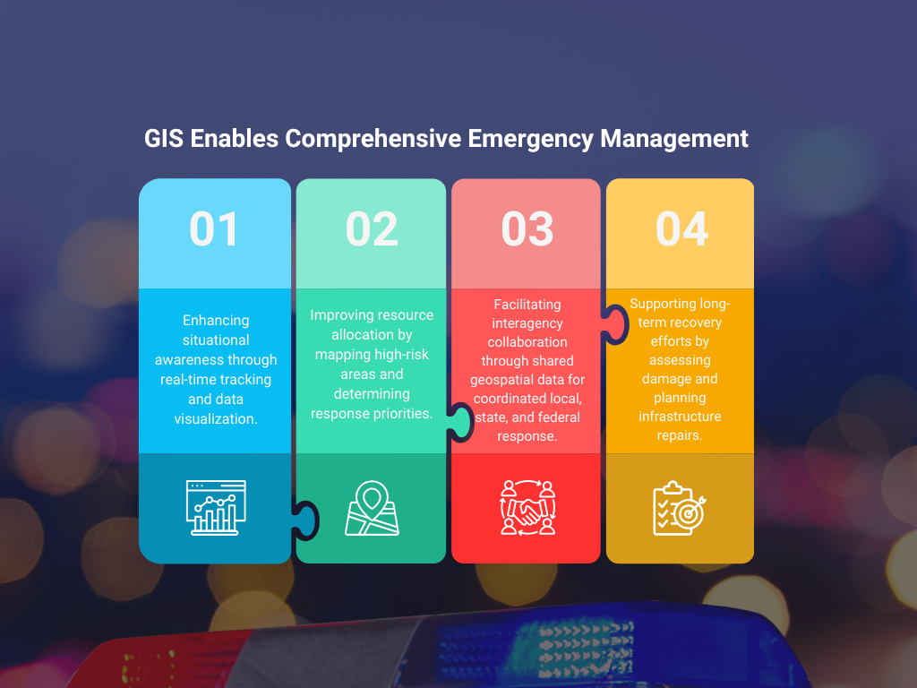
Why GIS is Essential for Effective Emergency Planning
GIS technology provides a comprehensive approach to emergency management by:
- Enhancing situational awareness through real-time tracking and data visualization.
- Improving resource allocation by mapping high-risk areas and determining response priorities.
- Facilitating interagency collaboration through shared geospatial data that ensures coordinated efforts between local, state, and federal responders.
- Supporting long-term recovery efforts by assessing damage and planning infrastructure repairs.
The Future of Emergency Response with GIS
As emergencies become more frequent and complex, the integration of GIS into emergency management strategies will become even more critical. Advancements in artificial intelligence (AI) and machine learning are further enhancing GIS capabilities, allowing for more accurate disaster predictions and response planning.
By investing in high-functioning GIS systems, emergency management agencies can significantly improve their preparedness, response, and recovery efforts, ultimately saving lives and reducing economic losses.
What are your thoughts on the role of GIS in emergency management? Share your insights and experiences in the comments below!


The Art of Simple: Solving Complex GIS Challenges