
5 GIS Stories Worth Your Attention in 2026 (and What They Mean for You)
The pace of change in geographic information systems can outrun even the people who follow it

The pace of change in geographic information systems can outrun even the people who follow it

Most counties don’t face an infrastructure crisis all at once — it arrives one water main
Southern Landscape Group serves two distinct markets across Central Virginia. Here’s how they used iGIS® to

When Thomas Road Baptist Church set out to knock on every door in Lynchburg for their

School emergency plans only go so far. See how indoor GIS mapping gives first responders accurate,

GIS is more flexible than its reputation suggests. Three organizations are using iGIS® in ways that

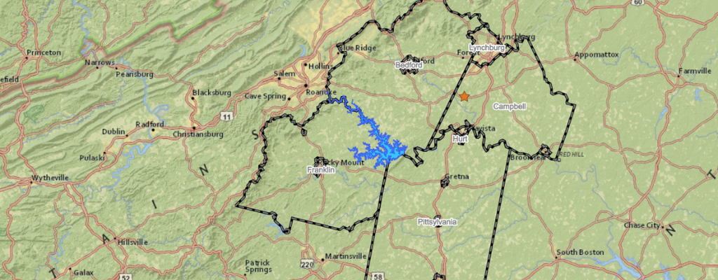
Virginia is part of a historic wave of mid-decade redistricting. For counties and localities, that means
For many small county governments, one person is the entire GIS department. This post breaks down

The satellite revolution isn’t coming—it’s already here. With constellations expanding from 15 to 120+ satellites, municipalities

Nearly 1 in 4 Americans lives with a disability, yet many government maps remain difficult or

The 2020-2024 American Community Survey 5-Year Estimates are now available, providing GIS planners with the first

Public works teams across the East Coast are asking the same question after this week’s winter