From 15 to 120 Satellites: What Better Imagery Actually Means for Your Community
Something remarkable is happening above our heads, and most people working in local government have no idea it’s about to change how they do their jobs.
Right now, roughly 15 satellites orbit Earth capturing imagery detailed enough to see objects as small as 30 centimeters. Within the next couple of years, that number explodes to over 120 satellites, thanks to ambitious expansions from Planet’s Pelican constellation, Vantor’s (formerly Maxar) WorldView Legion fleet, and Airbus’s Pléiades Neo satellites. Synthetic Aperture Radar constellations from companies like Iceye and Synspective are growing rapidly too, giving us the ability to see through clouds and darkness.
But here’s what matters for your community — more satellites doesn’t just mean prettier pictures. It means your GIS can finally do things that were impossible or prohibitively expensive just a few years ago.
What Changes When You Have More Eyes in the Sky
Think about how your department currently handles change detection. Maybe you’re comparing aerial photos from different years, trying to spot new construction, illegal dumps, or encroachments. With current imagery schedules, you might catch something months after it happens, when remediation is more complicated and more expensive.
When satellite revisit times drop from weeks to days or even hours, that equation flips entirely. You’re not investigating what happened three months ago; you’re catching issues while they’re still manageable. For code enforcement, this kind of monitoring capability means identifying unpermitted structures, tracking land use violations, and documenting environmental changes as they occur rather than discovering them during routine inspections or after neighbor complaints.
Real Applications Already Working
Humboldt County, California switched from a complaints-based enforcement model to proactive searching using satellite imagery, enabling investigators to identify violations and compel compliance at a much greater rate. An enforcement officer gets an alert that construction activity appeared in an area with no active permits. Instead of waiting for a complaint, they verify the situation with current imagery, document the timeline, and address it immediately. The property owner can’t claim the structure has been there for years because the imagery record tells the actual story.
Your planning department probably tracks tree canopy coverage, wetland health, or stormwater infrastructure impact. Traditionally, this meant sending staff into the field repeatedly or commissioning expensive aerial surveys. With frequent, high-resolution imagery, you monitor environmental conditions continuously without dispatching crews to physically check. For example, Fairfax County, Virginia has municipal environmental monitoring programs that track metrics like tree canopy changes and climate-related impacts over time, measuring progress rather than estimating it.
Assessment offices gain an objective record of property conditions over time. When did that pool get installed? The imagery answers definitively. Your assessment staff can track construction completion, verify improvements, and maintain equitable valuations across the jurisdiction without physically visiting every parcel annually.
How Municipalities Actually Access This Imagery
Here’s where the conversation gets practical. The technology exists and it’s operational right now, but how does a typical county or small town actually get access?
The Free Route: Government Data Sources
The most accessible starting point costs nothing. USGS EarthExplorer provides free access to Landsat imagery dating back to 1972 and Sentinel-2 data from the European Space Agency with just a free account registration. The Harmonized Landsat Sentinel-2 project combines both sources to deliver observations every 2-3 days at 30-meter resolution, handling many municipal needs like tracking land use changes and monitoring vegetation.
For communities just starting with satellite imagery or working with tight budgets, this is where you begin. The resolution won’t catch every detail, but it’s remarkably useful for broad monitoring and establishing baselines.
Commercial Imagery: Multiple Access Paths
For higher-resolution imagery from constellations like Vantor’s WorldView Legion or Planet Labs, municipalities access it through several paths:
Direct subscriptions let governments purchase access based on their specific area of interest. Alaska and Mississippi ran a 7-month pilot with Planet to explore solutions for their geographically challenging states, while New Mexico’s State Land Office used Planet data to discover violations worth $800,000 in fines. Pilot programs let you test capabilities before committing.
Many municipalities already access commercial imagery through existing GIS software without realizing it. Esri partners with Vantor to provide satellite imagery as part of ArcGIS subscriptions, so communities using Esri products may have access included.
Some states negotiate enterprise agreements giving all agencies and municipalities access. This allows comprehensive satellite data across an entire civil public administration. Regional planning organizations or municipal consortiums can aggregate demand to negotiate better rates.
For basic visualization without analytical requirements, Google Earth and Bing incorporate commercial satellite imagery into their free basemaps, though with limitations on currency and capabilities.
What About Cost?
Free government sources (Landsat/Sentinel) cost nothing beyond staff time to download and integrate. For commercial imagery, small pilot programs can start in the thousands of dollars for limited coverage. Full subscriptions for municipalities typically range from tens of thousands to hundreds of thousands annually depending on jurisdiction size and requirements. However, cost per square kilometer continues dropping as constellation capacity increases.
The calculation isn’t just about imagery cost — it’s about what you accomplish with it. The return on investment often appears quickly: when code enforcement becomes proactive instead of reactive, when assessment challenges decrease, when infrastructure decisions improve based on current conditions rather than outdated assumptions. These operational efficiencies and better outcomes frequently justify the subscription costs within the first year many times over. When code enforcement becomes proactive, when assessment challenges decrease, when infrastructure decisions improve, the return shows up in operational efficiency and better outcomes.
The Timeline: What’s Actually Operational Now
The expansion from 15 to 120+ satellites isn’t a future promise — it’s happening right now. Vantor’s WorldView Legion constellation entered commercial operations in October 2024, with six satellites currently collecting up to 3.6 million square kilometers of 30cm-class imagery daily and revisiting some locations up to 15 times per day. Planet Labs’ existing constellation serves government customers today. Additional satellites launch throughout 2025-2027, with capacity growing monthly.
The technology works. The question isn’t “when will this be available?” but rather “what’s the right access method for our needs and budget?”
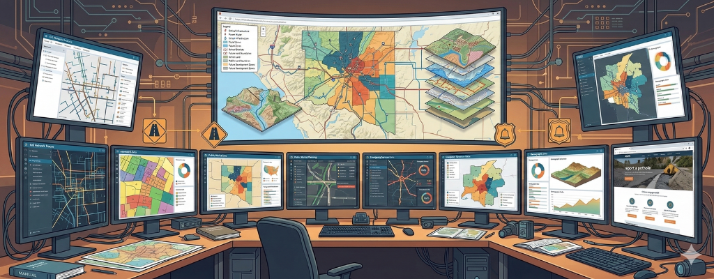
What This Means for Your Web GIS
The satellite revolution isn’t just about prettier basemaps. It’s about having access to information that transforms how departments work. The technology handles the complexity — scheduling satellite passes, processing imagery, detecting changes — while your staff sees actionable information through familiar mapping interfaces.
With increasing numbers of citizens and local government employees relying on online maps and data, uninterrupted accessibility to the most accurate information is imperative. InteractiveGIS, Inc. provides our customers with a reliable and feature-rich web-based Geographic Information System. Our customers can focus on GIS data and mapping without the worry that comes with online GIS hosting, server maintenance, and security.
For communities using web-based GIS platforms, integrating these improved imagery sources doesn’t require enterprise budgets or specialized expertise. Most municipalities should start by maximizing what’s free through Landsat and Sentinel, then evaluate whether specific use cases justify commercial subscriptions for high-value applications. A small town doing code enforcement doesn’t need the same solution as a state environmental agency tracking wildfires, and that’s exactly the point.
The jump from 15 to 120 satellites isn’t just incremental improvement, it’s the difference between checking conditions occasionally and maintaining continuous awareness of what’s happening across your entire jurisdiction. For local government, that shift turns reactive departments into proactive ones.
Ready to See What Better Imagery Could Do for Your Community?
InteractiveGIS works with municipalities across the country to build custom web-based mapping platforms that take advantage of the latest geospatial data sources — both free and commercial. We specialize in integrating multiple imagery sources so you’re not locked into a single provider, giving you flexibility to use free sources for routine work and add commercial imagery where it delivers the most value.
Interested in seeing how your data could work harder for you? Contact us to schedule a free demo using your own data, or explore our 8 Essential Web GIS Features guide to see what’s possible when you have the right tools working for your team.