Local governments face mounting pressure to attract businesses, engage residents, and boost tourism – often with limited resources and outdated tools. Geographic Information Systems (GIS) have emerged as a powerful solution, transforming how cities showcase their assets and make development decisions. While traditional methods often fall short, GIS technology offers a dynamic approach to visualizing and leveraging community data. Through examining several public case studies, we’ll explore how different cities have successfully implemented GIS solutions for economic growth.
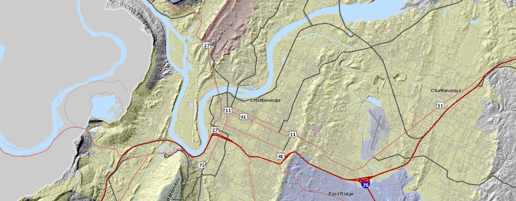
When Chattanooga’s economic development team struggled to attract new businesses in 2019, they didn’t expect a mapping tool would transform their approach. But after implementing their GIS-based property portal, they saw investor interest spike by 45% in just six months. The reason? Potential investors could now virtually explore available properties, check zoning requirements, and analyze transportation access – all before setting foot in the city.
This shift from traditional property listings to interactive mapping isn’t just changing how cities market themselves – it’s transforming how local governments drive economic growth. And it goes far beyond just property listings.
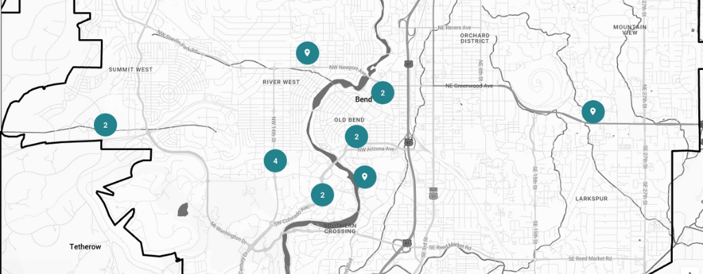
Take Bend, Oregon. The city’s tourism board faced a common challenge: how to maintain visitor interest during the off-season. Their solution? An interactive GIS-powered map highlighting everything from hidden hiking trails to local breweries. Visitors can now build custom itineraries based on their interests and even download maps for offline use. The result was striking – a 30% boost in off-season tourism within the first year.
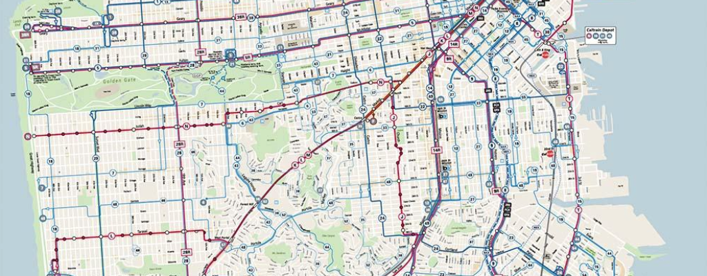
But the real power of GIS lies in its ability to layer complex data in intuitive ways. San Francisco’s transit authority learned this firsthand when they integrated real-time bus tracking with construction updates and traffic conditions. What started as a simple mapping project evolved into a comprehensive transit management system that both tourists and locals rely on daily.
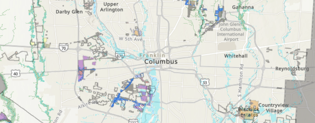
The impact on urban development has been equally profound. When Franklin County, Ohio needed to identify areas ripe for redevelopment, they turned to GIS. By overlaying population trends, property ownership data, and infrastructure quality assessments, they pinpointed perfect locations for mixed-use developments. One such project created 200 new jobs and sparked a neighborhood renaissance – all because they could visualize data in ways that revealed hidden opportunities.
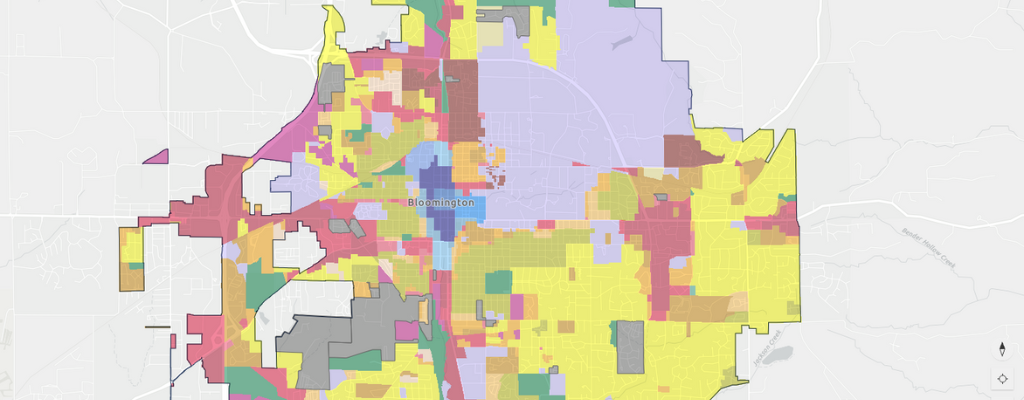
Community engagement has evolved too. Gone are the days of sparsely attended town halls. When Bloomington, Indiana planned a new park, they created an interactive GIS platform where residents could drop pins suggesting features and vote on design options. The platform even displayed real-time cost estimates for different proposals. This transparency led to record community participation and widespread support for the final design.
However, implementing GIS isn’t without its challenges. Cities often face initial resistance from staff comfortable with traditional methods. Budget constraints can limit feature sets, and maintaining updated data requires dedicated resources. But as Chattanooga and others have shown, the return on investment often justifies the initial hurdles.

The key to success lies in starting small and scaling up. Many cities begin with basic property mapping and gradually add layers of functionality – from demographic overlays to real-time transit data. Some partner with local universities for data analysis, while others engage tech-savvy businesses such as ours to help build out features.
Looking ahead, GIS promises even more potential for economic development. Augmented reality integrations could let investors virtually walk through available properties. AI-powered analysis could predict prime locations for specific business types. And improved mobile integration could make city resources more accessible than ever.
For local governments looking to drive economic growth, the question isn’t whether to adopt GIS, but how to implement it most effectively. The technology has moved beyond simple mapping to become an essential tool for showcasing opportunities, engaging communities, and making data-driven decisions that benefit everyone.
Ready to explore how GIS could transform your community’s economic development? The path forward starts with understanding your specific requirements and goals. What story could your city’s data tell if you had the right tools to visualize it?
Note: The case studies mentioned in this article are based on publicly available information and represent cities that have independently implemented GIS solutions. They are not affiliated with our services but demonstrate the potential impact of GIS technology in economic development.

