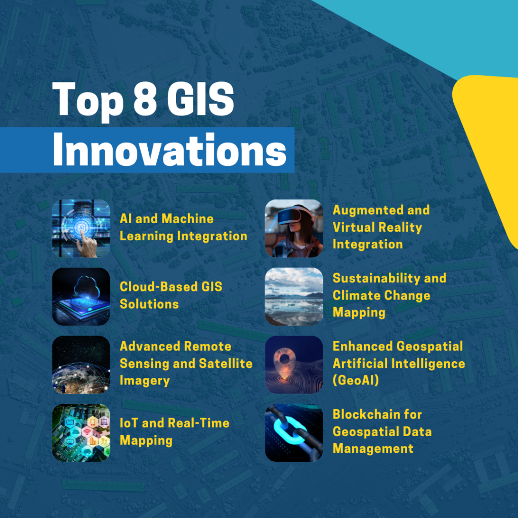
The GIS industry has seen some exciting innovations implemented on a greater scale this year! The convergence of cutting-edge technologies is revolutionizing how we understand, interact with, and interpret spatial data. GIS is experiencing a transformative moment, where artificial intelligence, cloud computing, and advanced sensing technologies are breaking down traditional barriers and opening unprecedented possibilities for spatial analysis.
For geospatial professionals, researchers, and innovators, these emerging trends represent more than just technological upgrades — they are powerful tools that promise to reshape our approach to mapping, environmental monitoring, urban planning, and global problem-solving. Let’s explore the eight most pivotal GIS technology innovations that we saw in 2024:
- AI and Machine Learning Integration
Advanced AI algorithms are now seamlessly integrating into geospatial workflows, transforming how we analyze and interpret spatial data. Machine learning has evolved from an experimental technology to a core component of sophisticated geographic information systems, enabling researchers and professionals to uncover complex patterns, predict geographical trends, and automate intricate feature extraction processes with remarkable precision and efficiency. - Cloud-Based GIS Solutions
Cloud platforms have democratized geospatial technology, making powerful mapping and analysis tools accessible to organizations of all sizes. These innovative solutions provide unprecedented scalability, collaborative capabilities, and real-time data processing that were once unimaginable in traditional GIS environments. - Advanced Remote Sensing and Satellite Imagery
The revolution in remote sensing technology has dramatically enhanced our ability to monitor and understand the Earth’s surface. High-resolution satellite imagery, combined with increasingly sophisticated sensors, now offers granular insights into environmental changes, urban development, agricultural patterns, and global ecological shifts with a level of detail and frequency that was previously unattainable. - IoT and Real-Time Mapping
The Internet of Things (IoT) has transformed geographic information systems into dynamic, continuously updating platforms. By integrating data from countless connected devices, GIS professionals can now create real-time maps that provide instantaneous insights into traffic patterns, environmental conditions, infrastructure performance, and urban dynamics. - Augmented and Virtual Reality Integration
Augmented and virtual reality technologies are breaking down the traditional boundaries of spatial visualization. These immersive technologies are enabling GIS professionals to create interactive, three-dimensional representations of geographical data, making complex spatial information more accessible and comprehensible for researchers, planners, and decision-makers. - Sustainability and Climate Change Mapping
GIS has emerged as a critical tool in understanding and addressing global environmental challenges. By leveraging advanced spatial analysis techniques, researchers can now track biodiversity, monitor forest cover, assess sea-level changes, and develop sophisticated predictive models that support climate adaptation and mitigation strategies. - Enhanced Geospatial Artificial Intelligence (GeoAI)
Geospatial Artificial Intelligence represents the next frontier in spatial analysis. Deep learning algorithms are now capable of recognizing intricate geographic patterns, predicting complex spatial trends, and providing actionable insights across diverse domains, from urban planning and resource management to risk assessment and environmental monitoring. - Blockchain for Geospatial Data Management
Blockchain technology is introducing unprecedented levels of security and transparency to geospatial data management. By creating decentralized, tamper-proof systems for storing and sharing geographic information, this technology promises to revolutionize land registry systems, property management, and collaborative spatial data initiatives.

Don’t Miss Our Webinar: Transforming GIS Challenges into Opportunities
To wrap up this remarkable year in GIS, we invite you to join us for an exclusive webinar hosted by David Bradshaw, CEO and Founder of InteractiveGIS. Whether you’re a GIS manager or an executive, this is your opportunity to gain actionable insights and learn from one of the leading voices in GIS innovation.
Webinar Details:
- Date: Thursday, December 19, 2024
- Time: 2 PM ET | 1 PM CT | 12 PM MT | 11 AM PT
- Featuring: David Bradshaw, CEO and Founder of InteractiveGIS
What You’ll Gain:
- Solutions to Common GIS Challenges: Learn how to overcome bottlenecks, inefficiencies, and recurring pain points in your workflows.
- Cutting-Edge Tools and Technology: Discover how the latest GIS advancements can revolutionize your operations.
- Actionable Strategies: Walk away with clear, practical steps to empower your team and boost productivity.
- Exclusive Insights: Leverage David Bradshaw’s decades of experience in transforming GIS systems for organizations nationwide.
Why You Should Attend:
You’ll leave with a clear roadmap to improve your GIS systems, along with exclusive resources to get started immediately. Attendance is FREE, but spots are limited, so don’t miss out!
Register Now to Reserve Your Spot!
Let’s make 2025 your most successful year yet in GIS innovation. See you at the webinar!


