
Why the NSDI Plan Matters (Even If You’ve Never Heard of It)
Most GIS teams are laser-focused on their own backyard—keeping parcels accurate, storm drains mapped, and utility crews equipped. But there’s a national plan quietly reshaping how all this local work connects to a much bigger picture: the National Spatial Data Infrastructure (NSDI) Strategic Plan 2025–2035.
This federal initiative lays out a bold goal—create a seamlessly interconnected geospatial ecosystem across federal, state, local, and tribal agencies. That might sound abstract, but the impact is very real. Here’s how it could show up in your day-to-day work.

Smarter Cities Need Smarter Maps
You’ve got traffic sensors, smart water meters, and maybe even public kiosks feeding your GIS—but is that data connected in a way that helps your city operate smarter?
The NSDI plan pushes for national standards that make it easier to bring IoT data, urban sensors, and even citizen-submitted issues into a central GIS. That means your city could optimize lighting, water usage, or sidewalk repairs based not just on technician reports—but on real-time public feedback.
It’s not science fiction—it’s just good mapping.

Public Health Gets a Location Upgrade
Gone are the days of static charts and slow reporting. The plan promotes using GIS to map demographics, healthcare access, and disease patterns with much greater precision.
Think about it: with standardized, layered geospatial data, health departments could plan vaccination sites in real time based on shifting population density or emerging hotspots. Emergency planning becomes proactive instead of reactive.
If your team supports public health, this is one of the clearest examples of why alignment with national geospatial strategies matters.
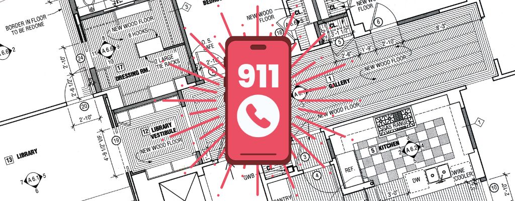
Faster, Smarter Emergency Response
The NSDI Plan is also helping to power the rollout of Next Generation 9-1-1—which isn’t just about better call routing. It’s about location intelligence in real time.
Picture this: dispatchers receive not only a caller’s location but also floorplans of the building, nearest hydrants, and traffic conditions en route. GIS teams that are aligned with NSDI data standards will be better equipped to support this level of service when seconds matter most.

So What’s the Takeaway?
Even if you’re not working at the federal level, the NSDI Plan is a chance to future-proof your local GIS efforts. Standardized data = better collaboration, better funding opportunities, and better outcomes for your community.
The NSDI Strategic Plan isn’t just a policy document. It’s a shared blueprint—and your team plays a critical role in bringing it to life.
Explore the full plan here.
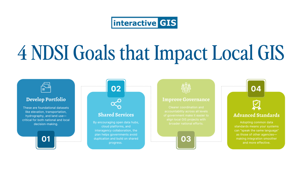
What’s Driving the NSDI Plan Forward?
The 2025–2035 Strategic Plan is built around four core goals that directly impact how local governments interact with national geospatial systems:
- Develop the National Geospatial Data Asset (NGDA) Portfolio
These are foundational datasets like elevation, transportation, hydrography, and land use—critical for both national and local decision-making. - Promote Shared Services and Partnerships
By encouraging open data hubs, cloud platforms, and interagency collaboration, the plan helps governments avoid duplication and build on shared progress. - Improve Geospatial Governance
Clearer coordination and accountability across all levels of government make it easier to align local GIS projects with broader national efforts. - Advance Data Standards and Interoperability
Adopting common data standards means your systems can “speak the same language” as those of other agencies—making integration smoother and more effective.
For any city or county working to modernize their GIS, these goals reinforce the importance of flexible, open, and collaborative approaches.
Need help aligning your GIS with the bigger picture?
InteractiveGIS specializes in customized web-based mapping tools that meet your exact needs—without the one-size-fits-all limitations. We’d be happy to show you what that looks like using your own data.

