


Southern Landscape Group (SLG) was founded by Mark Maslow in 1998 and has grown into a team of 50 landscape professionals serving the Central Virginia region, including Smith Mountain Lake, the greater Lynchburg area, and surrounding counties. They design, build, and maintain high-end residential and commercial outdoor spaces, from custom patios and water features to full-scale hardscape installations.(portfolio) After more than 28 years in business, SLG has built a strong reputation and a substantial client base spread across two distinct geographic markets.
That geographic spread, it turns out, is both a strength and a logistical challenge.
The Problem: Flying Blind with Expensive, Outdated Data
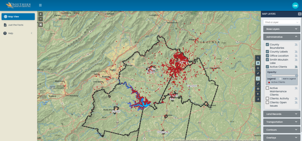
Running crews across Lynchburg and Smith Mountain Lake means managing route density carefully. Fuel is expensive, drive time adds up fast, and sending a crew 45 minutes down the road for a single job that sits in isolation from other clients is the kind of inefficiency that erodes margins. SLG knew the problem existed, but their existing tools couldn’t surface it clearly.
Their CRM software managed client records and communications well enough, but it had no mapping capability. There was no way to look at a customer list and see where those customers actually lived relative to one another or relative to active crew routes. The data just sat in columns and rows, unable to answer the one question that mattered most — where are we, and where should we be going next?
On top of that, purchasing geographic and parcel data from third-party data vendors came with two consistent frustrations: the cost was significant, and the data was often months or even years out of date. Data companies update on their own schedule, not yours, which means property transfers, new construction, and address changes could easily slip through the cracks. For a company whose growth strategy depends on reaching the right property at the right moment, stale data is a real business liability.
The Solution: iGIS® as a Strategic Operations and Marketing Platform
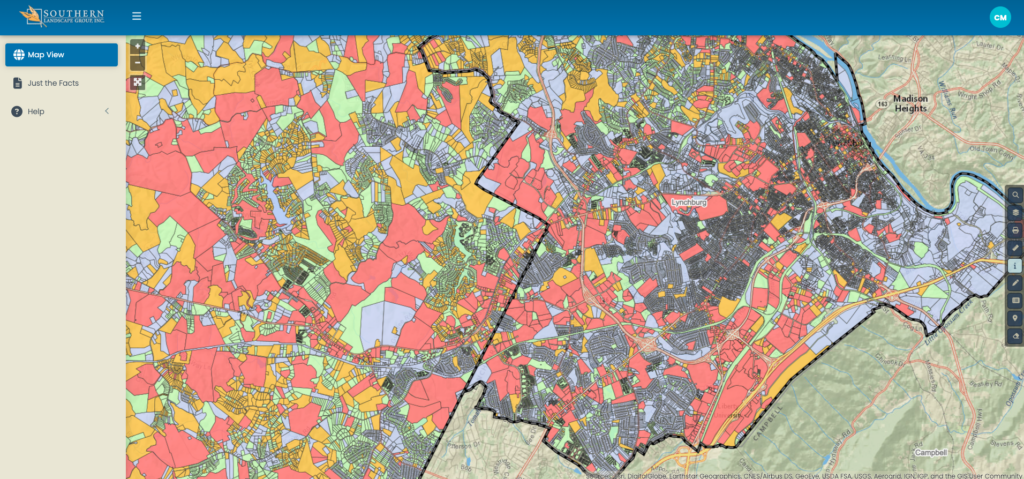
SLG partnered with InteractiveGIS to implement iGIS® as their central mapping and spatial data platform. Rather than purchasing data that was already aging by the time it arrived, iGIS® connects directly to authoritative government addressing and parcel data, providing current, reliable information without the overhead cost of third-party data subscriptions. The result is a living, color-coded view of properties, parcel ownership, zoning, property values, special use designations, and land transfer activity, all in one place.
For a landscaping company, that kind of visibility changes how decisions get made.
How SLG Uses iGIS®: Four Core Applications
Route Density and Crew Efficiency
The most immediate operational benefit was the ability to map active clients geographically. Once SLG’s customer data was visualized on the iGIS® platform, patterns emerged that a spreadsheet could never reveal. Clusters of clients in certain neighborhoods or lake communities became obvious, as did the gaps between service areas where a single new client could anchor a more efficient route.
With fuel costs a consistent line item in any field service business, the math on route density is straightforward. A crew that services eight clients within a two-mile corridor is fundamentally more profitable than the same crew servicing eight clients spread across twenty miles. iGIS® gave SLG the spatial clarity to make that argument with data, not intuition, and to make intentional decisions about which areas to prioritize for new client acquisition.
Neighbor Notification Postcards
When SLG takes on a longer-term project in a neighborhood, they send neighbor notification postcards to nearby properties. It is a professional courtesy and, frankly, a smart marketing move. A neighbor watching a crew transform the property next door is already a warm prospect.
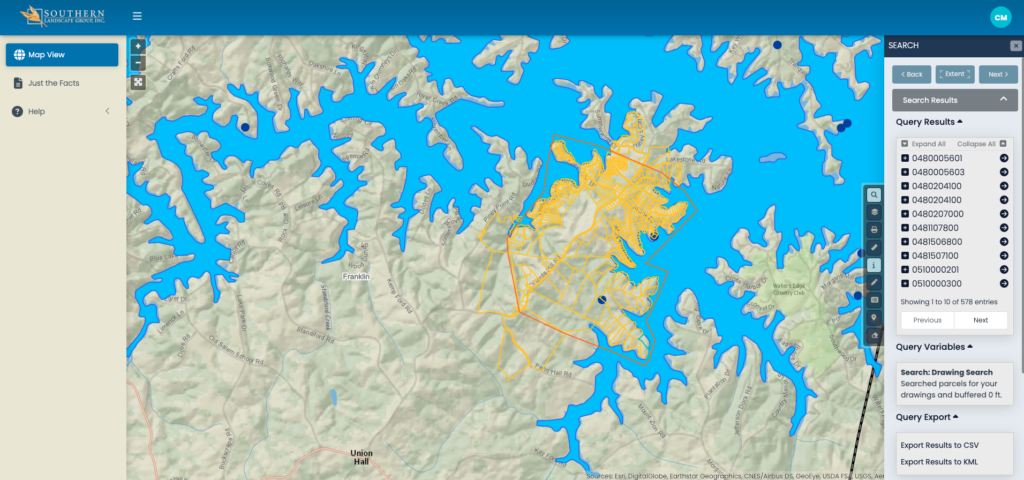
iGIS® makes pulling that address list simple. Rather than manually identifying adjacent properties or relying on rough guesses about who might be nearby, SLG can use the platform’s parcel data to identify the specific addresses surrounding a project site and export them for a direct mail run. The data is current because it draws from government addressing records, which means the postcards reach real mailboxes rather than bouncing back as undeliverable.
New Build and Property Transfer Targeting
One of the more powerful applications of current parcel data is the ability to identify new construction and recent property transfers. Parcel records include transfer date fields that make it easy to filter for properties that have recently changed hands or been newly recorded. For SLG, that is a trigger. A new homeowner is often thinking about the outdoor space they want to create, and a welcome packet that arrives early in that process, before three other landscapers have already knocked on the door, carries real weight.
This kind of right-moment targeting is only possible when your data is current. Months-old transfer records are months-old opportunities.
Property-Level Intelligence for Strategic Segmentation
Beyond knowing where clients and prospects are, iGIS® allows SLG to understand the character of properties at a glance through its color-coded layer system. Property values, zoning classifications, parcel size, special use designations, and vacant land indicators are all visible without leaving the map. For a company like SLG, which serves everything from residential estates in Lynchburg to lakefront properties along Smith Mountain Lake, the ability to segment by property type and value without exporting data into a separate tool is a meaningful efficiency gain.
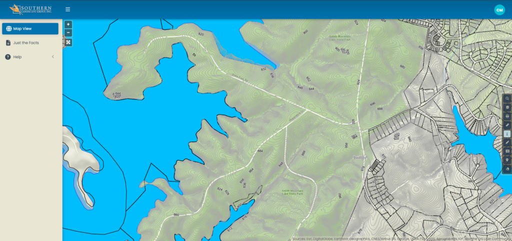
The lakefront service area in particular benefits from this kind of layered intelligence. Shoreline properties carry their own set of considerations, from slope and access to AEP shoreline regulations that affect what can be designed and built near the water. Having that context visible on the same map where SLG is planning its outreach removes a step from the research process and keeps decision-making grounded in accurate, location-specific data.
The Bigger Picture
What SLG has built with iGIS® is something their previous tools could not have supported: a marketing and operations strategy that is spatially informed at every level. Routes are planned around where clients actually are. Direct mail targets neighbors who have already seen SLG’s work firsthand. New build campaigns reach property owners before the window closes. And every property in the service area can be evaluated for fit and priority based on real data rather than assumptions.
That shift, from managing a client list to reading a living map of your service territory, is the practical value of connecting operational data to current geographic intelligence. For field service businesses managing crews, routes, and growth across a spread-out service area, it is the kind of clarity that compounds over time.
Interested in seeing what iGIS® could look like for your business? Request a demo at interactivegis.com and bring your own data to the table.