


July 4th gets remembered as the day a small group of colonies declared themselves a country and committed to fighting for it. What it doesn’t get remembered for, at least not at backyard barbecues, is how messy the aftermath turned out to be.
Independence settled the question of who would govern. It did almost nothing to settle the question of where anything actually was. For a brand-new country sitting on millions of acres of land it had no agreed-upon way to describe, that turned out to be a serious problem.
The Old Way Was a Mess
Before the war, land in the colonies got described the old-fashioned way, by metes and bounds. A property line ran from this boulder to that bend in the creek, then followed the ridge to the old oak tree, then cut back toward the road.
It worked fine in small, long-settled communities where everyone knew the landmarks. It fell apart fast once the new nation needed to sell huge stretches of unfamiliar western territory to pay off war debt. Landmarks move. Trees fall. Creeks shift course. Disputes over exactly where a boundary sat could drag on for generations.
Abraham Lincoln’s own family got caught in exactly this kind of mess, eventually settling on Indiana land that had been surveyed under the newer township system after losing a Kentucky property to a boundary dispute. Lincoln wrote that his father left the Bluegrass state “partly on account of slavery; but chiefly on account of the difficulty of land titles in Kentucky.” If a future president’s family couldn’t escape a bad boundary dispute, nobody could.
Congress Draws a Grid
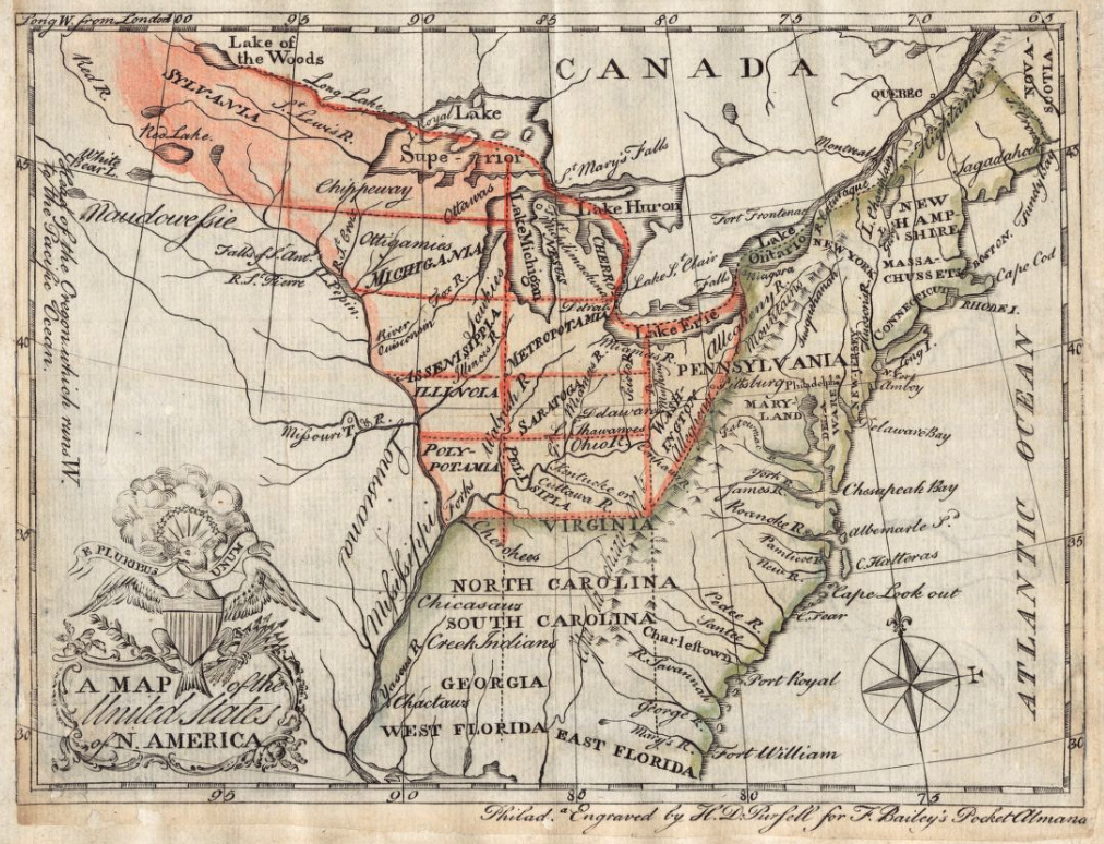
Congress needed something more durable, and in 1785 it got one. The Ordinance of 1785 was landmark legislation, dividing land into six-mile-square townships that were further split into thirty-six one-mile sections of 640 acres apiece.
The ordinance went into remarkable detail, even spelling out exactly how the survey’s starting point would be located and how each piece of land should be divided. Every section followed an identical numbering pattern across the entire system, starting in the southeast corner of each township and snaking north through each column before shifting one column west, all the way up to section 36 in the northwest corner.
Here’s what made that worth doing right. The pattern never changed, no matter which township you were standing in. Section 16 always sat in the same relative spot, dead center of its township, whether that township was in eastern Ohio or three states further west. A surveyor, buyer, or government clerk anywhere in the territory could read “Township 4, Range 2, Section 16” and know precisely where that land sat without ever laying eyes on it. It worked the same way for every township, every time, which is exactly what made it possible to repeat across millions of acres without the system collapsing into a different set of rules for every county. That kind of consistency was the entire point.
Fun Facts Buried in the Fine Print
A few details are worth knowing just because they’re genuinely fun trivia.
The ordinance reserved lot number 16 in every township for the maintenance of public schools, written directly into the original legislative text. A lot of those sections eventually got sold off to raise education money instead, but the practice was rooted in an English custom the colonies had inherited, one that traced even further back to ancient Greek and Egyptian land endowments for schools.
The same document reserved lots numbered 8, 11, 26, and 29 in every township for the federal government’s future sale. Officials held onto those particular sections because they expected the surrounding land to grow more valuable once settlers moved in, and could reserve even more if valuable resources turned up. Notice that these are the same four numbers, every single time, in every township across the system. Nothing here was left to chance. That’s an early version of land speculation, government edition, run with the same precision as the numbering grid itself.
The ordinance even included sample language for how property deeds themselves should be written, down to setting aside land for soldiers who had served in the Continental Army. Congress basically wrote the template language lawyers would copy for the next century.
The Part That Wasn’t So Fun
None of this happened without friction, and the full story deserves both sides.
The minimum purchase came to 640 acres for $640, a price most ordinary settlers in the late eighteenth century simply couldn’t afford. A far less defensible consequence followed too. The survey and sale of this land moved forward on territory that had been forcibly taken from the indigenous Native American nations who already inhabited it.
The grid solved a real, practical problem for the young country. It also did so by imposing a foreign system onto land and people who had never asked for it. Good history holds both facts at the same time.
Still Visible From an Airplane Window
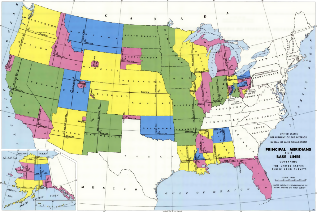
Here’s the part that turns this from a history lesson into a genuinely cool fact. The Public Land Survey System that grew out of the 1785 ordinance became the method used to survey and divide land across the country, and it remains the framework behind how property is described in much of the United States today.
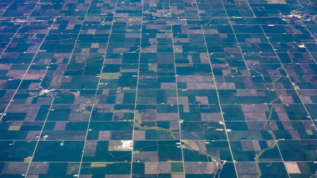
Fly over Ohio, Indiana, or Iowa on a clear day and you can watch the grid pass underneath the plane. Mile after mile of right angles, laid down by hand with a chain and a compass before anyone had heard of a satellite.
The ordinance laid the groundwork for nearly all the land legislation that followed it, including the Homestead Act, and shaped settlement patterns across the Northwest Territory and beyond. Next time you’re on a flight and look out the window at a perfect checkerboard of farmland, you’re looking at a 240-year-old decision.
Why This Still Matters Today
This is also, in a roundabout way, the ancestor of the parcel data sitting inside a modern GIS platform like iGIS®. The instinct behind the Land Ordinance was simple. Replace vague description with precise measurement, so a piece of land could be identified the same way by anyone, anywhere, without an argument. Two hundred and forty years later, that’s still the entire point of parcel mapping.
A county GIS team pulling up a property boundary today is doing a faster, digital version of exactly what those Continental Congress surveyors set out to do with a chain and a compass. Independence didn’t just need a flag and a declaration. It needed a way to know where one piece of ground ended and the next one began, and that need hasn’t gone anywhere. It just got a much better map.
Sources for reference:
- Land Ordinance of 1785, Encyclopedia Virginia (transcription of the original ordinance text)
- Continental Congress: Land Ordinance of 1785 – Encyclopedia.com
- Ordinance of 1785 – U-S-History.com
- Land Ordinance of 1785 – U.S. House of Representatives History, Art & Archives
- Sixteenth Section Land History – Madison County Schools, Mississippi
- Land Ordinance of 1785 – Fiveable Study Guide

Five Things People Get Wrong About Web-Based GIS